As a person who never studied world geography (or maybe slept through it?), I find it fascinating with the idea that my children are able to draw maps of the world freehand by the end of 7th grade! Although it seems impossible, taking baby steps to get there certainly has made it possible for us. (And to think I could barely fill in the state names on a blank copy of a U.S. map by the end of 7th grade!)
With our lower elementary level children, we practice tracing maps and drawing circular “blob” maps (sort of inconsistently, ahem…) in addition to our geography memory work. But I’ve wanted to have a slightly more accurate “blob” map to work with so that it becomes more natural to transition to the actual shapes of the continents. So, after a year of procrastination…

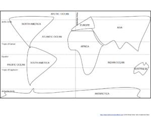
There are two sets – one to use across an entire sheet of paper (for simply learning to do this freehand on a sheet of paper without a template) and another that uses a more accurate spacing for the major circles of latitude (since an 8.5″ x 11″ piece of paper is not wide enough for accurate spacing).
Scroll down to download an example of each map, or purchase a formatted PDF digital download of the entire Continental Blob Mapping Packet for your family or classroom, along with simple instructions for use. This pdf now includes the Southern Ocean!
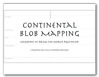
Continental Blob Mapping Packet
Item: Continental Blob Mapping Packet Family or Classroom License
Price: $5.99 (for family or classroom use)
Format: PDF Download (13 pages)


Are you a director of a co-op or school? Purchase the community license!
Item: Continental Blob Mapping Packet Community License
Price: $12.99 (reproducible for community use, up to 60 children)
Format: PDF Download (13 pages) – Community License
Our 4th grader is using these to memorize the placement of the continents without looking at a map. For those who previously read our Breakfast Notebook post, this is included as one of our notebooking activities. It takes less than 5 minutes (unless we are working on a grid map).
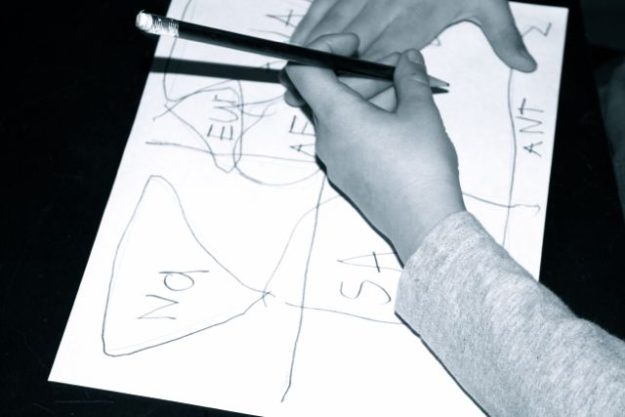
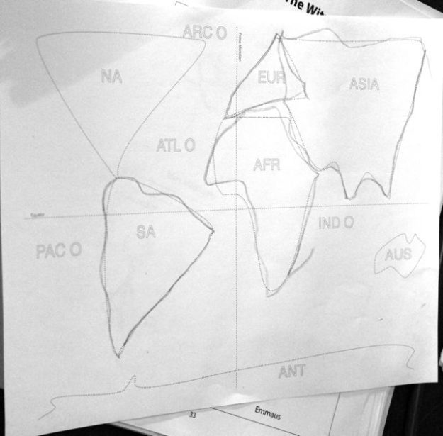
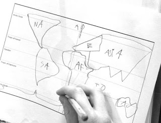
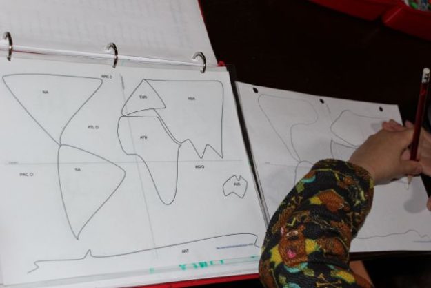
These templates provide another version of continental “blob” mapping using a combination of triangles and rectangles with curved edges – simple drawings that can still be easily memorized but a bit more accurate than the circles and ovals we were previously drawing.
The maps below do not include the Southern Ocean. The Southern Ocean update, along with additional maps (such as the blobs without labels), are included in the Continental Blob Mapping Packet.
Blob Maps with Equator & Prime Meridian Only. To download a free copy of each page shown below, click on the captions below each picture.
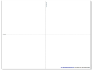
Blob Map Full-Page Traceable Continents/Abbreviations]
Blob Maps with Great Circles. To download a free copy of each page shown below, click on the captions below each picture.
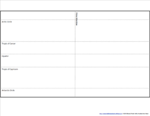
Blob Map w/ Latitudes – Master Copy
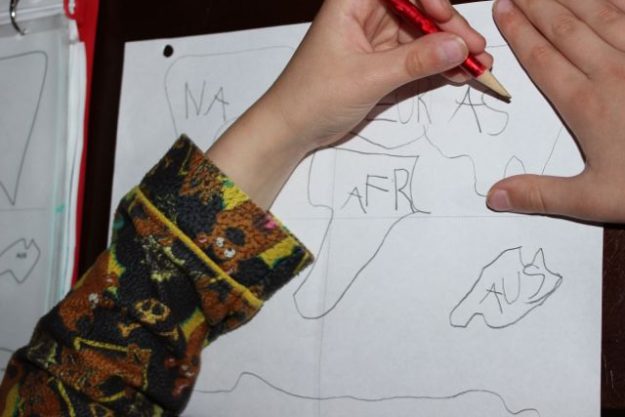
How we’ve used blob maps during our notebook time.
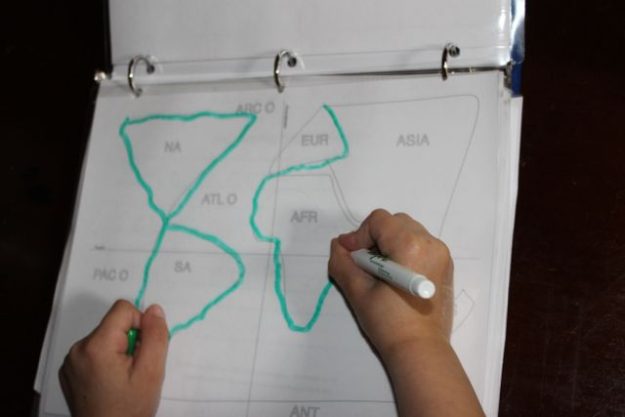
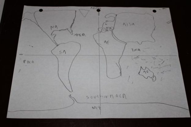
I especially enjoyed his interpretation of Oceania. (Hey! That’s how I would draw it!)
Note: We have taught geography for a few years now, so our 9-year-old has seen the world maps over and over again. And he’s traced laminated maps with markers over and over again. Repetition is what made him familiar with the extra details, but the blob maps have helped him to place the continents more accurately on a blank sheet of paper with very little effort.
After your student has a concept of the world with blob mapping, you will want to focus on drawing each continent in greater detail. For this, we recommend Draw the World.
During our study of American history we use Draw the USA to memorize the states. It’s a great way to simplify memorizing how to draw the USA free-hand. In fact, we recommend the entire Draw the… [Continent] books by Kristin Draeger.
If you’re looking for maps to practice tracing the world, visit Map Tracing: A Geography Plan with Printable Atlas. To learn how to draw each continent freehand, check out the Chalk Pastels membership (which includes hundreds of simple art projects to reinforce history, literature, science, and other subjects.)
Purchase a formatted PDF digital download of the entire Continental Blob Mapping Packet with simple instructions.
Suggested grades: Preschool to 3
Price: $4.99 (for family or classroom use)
Format: PDF Download, For individual family or classroom use.
Are you a co-op director? Purchase the community license!
Price: $9.99 (reproducible for community use, up to 60 children)
Format: PDF Download (13 pages) – Community License
In elementary school, our youngest children ended up memorizing all the countries of the world through Kathy Troxel’s Audio Memory Geography Songs CD/Booklet, which is now used in our Mission: World Wonders and Mission: Faith Forgers curriculum. Highly recommended!
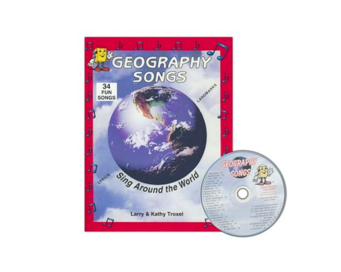
Geography Songs CD, Book, & Map Kit
Memorize the world through song! Divided by geographical regions, these echo-style songs make it simple to memorize the countries of the world. The audio CD includes 34 songs that teach the names of 225 countries, the continents & oceans, and the planets of the solar system. This resource is used in our Mission: World Wonders and Mission: Faith Forgers curriculum.
Suggested grades: Elementary through Middle School
Price: $22.95
Format: Kit consists of an audio CD, a 25″ x 36″ world map with items to label and song lyrics, and a family-reproducible workbook with lyrics and maps. Purchase here on Christian Book Distributors.

 Draw the World
Learn to draw the world from memory! Draw the World provides students with a simple method of committing a continent outline map of the world to memory. Through simple, step-by-step instructions, students learn to draw each continent as it connects to neighboring continents. This resource is also used in the Mission Pacific Peacemakers Six-Week Unit Study.
Suggested grades: Elementary through High School
Price: $19.95
Format: Paperback.

Draw the USA
Learn to draw and label the United States of America from memory! Draw the USA provides students with a simple method of committing the map of the USA to memory. Through simple, step-by-step instructions, students learn to draw each state as it connects to neighboring states. This resource is used in Units 5 & 6 of our Mission: Lasting Liberty curriculum.
Suggested grades: Elementary through High School
Price: $19.95
Format: Paperback.
![]()


